Scientists unearth enormous hidden aquifer beneath Oregon’s Cascade Mountains
01/17/2025 / By Willow Tohi
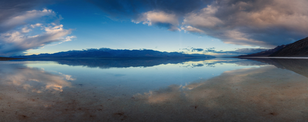
- Scientists have discovered a massive underground aquifer beneath Oregon’s Cascade Mountains, containing at least 81 cubic kilometers of water – more than twice the volume of Lake Mead.
- The aquifer, described as a “continental-size lake stored in the rocks,” is likely the largest of its kind in the world, with potential similar reservoirs in other volcanic regions.
- Researchers used temperature data from deep drill holes to map the aquifer, revealing it is far larger than previous estimates based on surface water measurements.
- The discovery has significant implications for water management in the drought-stricken Western United States, offering a potential source of water security but also highlighting the need for careful stewardship.
- The aquifer’s existence also sheds light on the link between water and volcanic hazards, emphasizing the importance of further research to assess potential risks.
In a groundbreaking discovery that could reshape how people think about water resources and volcanic activity, scientists have uncovered an enormous aquifer hidden beneath the volcanic rocks of Oregon’s Cascade Mountains. This colossal underground reservoir holds at least 81 cubic kilometers of water — more than twice the volume of Lake Mead, the largest reservoir in the United States. The findings, published in the journal Proceedings of the National Academy of Sciences, reveal a hidden treasure that could have far-reaching implications for water management in the drought-stricken West and our understanding of volcanic processes.
A continental-scale water tower
The newly discovered aquifer is described as a “continental-size lake stored in the rocks at the top of the mountains, like a big water tower,” according to Leif Karlstrom, an Earth scientist at the University of Oregon and co-author of the study. The aquifer’s immense size makes it likely the largest of its kind in the world, with similar volcanic aquifers potentially existing north of the Columbia Gorge and near Mount Shasta.
The Cascade Range, stretching 700 miles from Northern California to British Columbia, has been shaped by millions of years of volcanic activity. The region’s volcanic rocks, some as old as 45 million years, have created a unique landscape where water flows through cracks and fissures, forming vast underground reservoirs. The discovery of this aquifer was unexpected, as researchers initially set out to study how the Cascade landscape evolved over time and how water moves through it.
“We discovered important things that people care about: the incredible volume of water in active storage in the Cascades and also how the movement of water and the hazards posed by volcanoes are linked together,” said Gordon Grant, a hydrologist with the U.S. Forest Service and co-author of the study.
A natural laboratory for water and volcanoes
The Cascade Range is divided into two distinct zones: the older Western Cascades, characterized by deep valleys and steep slopes carved by rivers, and the younger High Cascades, marked by flatter terrain, lakes, and volcanic features like lava flows. The transition zone between these two regions, particularly around Santiam Pass, served as a natural laboratory for the study.
To map the aquifer, researchers analyzed temperature data from deep drill holes originally created in the 1980s and 1990s during geothermal energy exploration. Normally, rocks get hotter as depth increases, but the team found areas where temperatures remained constant, indicating the presence of water cooling the rocks. By pinpointing where temperatures began to rise again, the scientists could estimate the depth and volume of the aquifer.
This method revealed that the aquifer is far larger than previous estimates, which were based solely on surface water measurements like river and stream discharge. While the current estimate of 81 cubic kilometers is already staggering, researchers believe the actual volume could be even greater, as the drill holes did not cover the entire region.
Implications for water management and volcanic hazards
The discovery of this massive aquifer comes at a critical time for the Western United States, where there has been reduced snowpack and intensifying droughts, straining water resources. Most Oregonians rely on water originating from the Cascades, such as the McKenzie River, which supplies drinking water to Eugene. The aquifer’s size offers a glimmer of hope for water security, but scientists caution that it is not an infinite resource.
“It is a big, active groundwater reservoir up there right now, but its longevity and resilience to change is set by the availability of recharging waters,” Karlstrom explained. The aquifer is primarily replenished by snow, but with snowpack expected to continue to decline for the coming decade, its future is uncertain.
The discovery also has significant implications for understanding volcanic hazards in the region. When magma interacts with large volumes of water, it can lead to explosive eruptions that blast ash and gas into the air, rather than slower-moving lava flows. This connection between water and volcanic activity underscores the importance of further research to assess potential risks.
A geological gift that demands careful stewardship
While the discovery of the aquifer is a cause for celebration, it also raises critical questions about how to manage this precious resource. “This region has been handed a geological gift, but we really are only beginning to understand it,” Grant said. “If we don’t have any snow, or if we have a run of bad winters where we don’t get any rain, what’s that going to mean? Those are the key questions we’re now having to focus on.”
As scientists continue to study the aquifer, policymakers and water managers will need to balance the need for water security with the imperative to protect this fragile resource.
The study, titled “State shifts in the deep Critical Zone drive landscape evolution in volcanic terrains,” marks a significant step forward in people’s understanding of the Cascade Range and its hidden treasures. As researchers delve deeper into the mysteries of this vast aquifer, one thing is clear: the Cascades hold more than just towering peaks and lush forests – they are home to one of the planet’s most remarkable water reservoirs.
Sources include:
Submit a correction >>
Tagged Under:
Cascade Mountains, clean water, climate science, cool science, discovery, natural resources, Oregon, research, volcanic hazards, volcanoes, water supply, Water Wars
This article may contain statements that reflect the opinion of the author


